


Outdoor GPS Shop
TwoNav Terra(32 GB) + 1 zone of GB Ordnance Survey 1:50K mapping
TwoNav Terra(32 GB) + 1 zone of GB Ordnance Survey 1:50K mapping
Regular price
£289.00 GBP
Regular price
£299.99 GBP
Sale price
£289.00 GBP
Unit price
per
Taxes included.
Shipping calculated at checkout.
Couldn't load pickup availability
TwoNav Terra (32gb) + 1 zone of Great Britain Ordnance Survey 1:50K mapping
Feel the thrill of exploring without limits
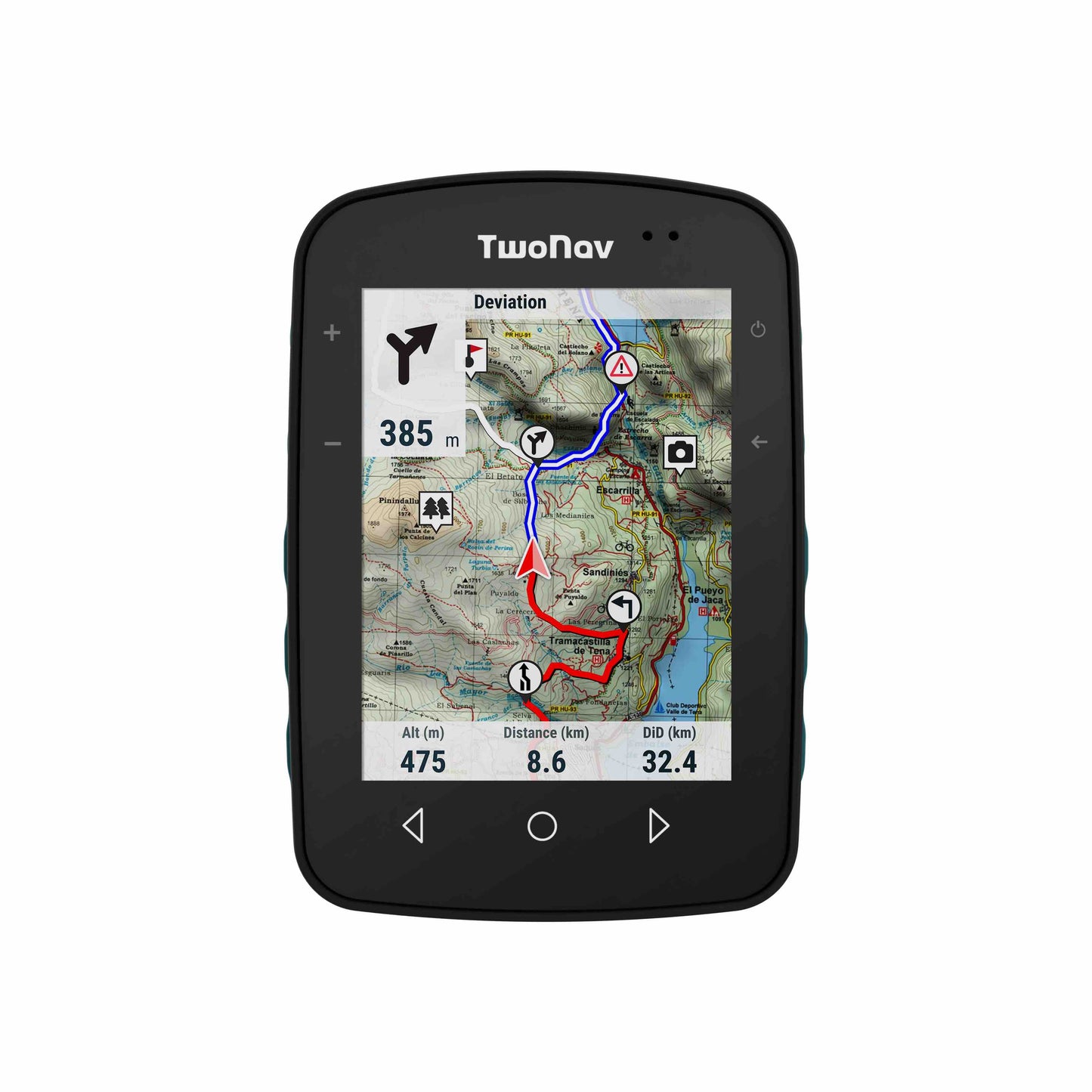
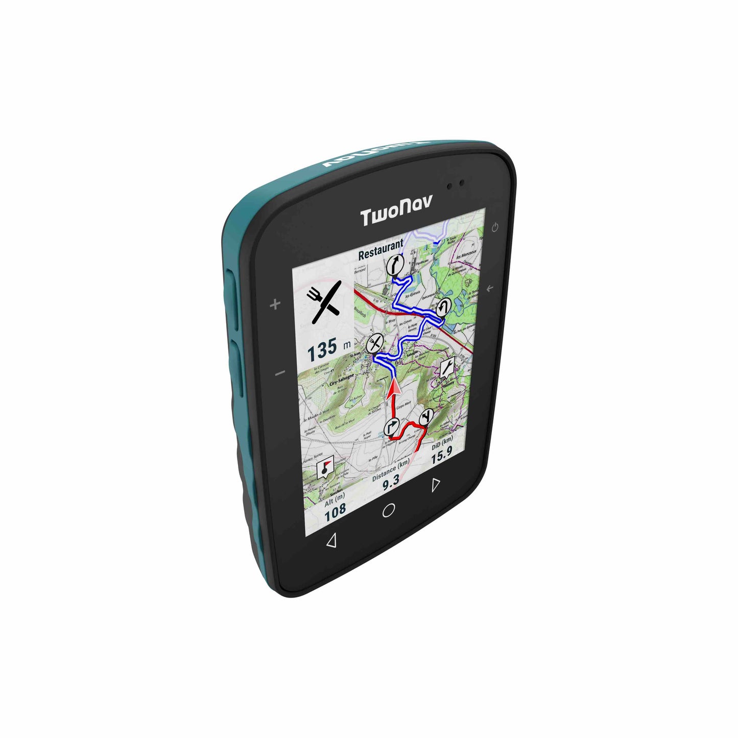
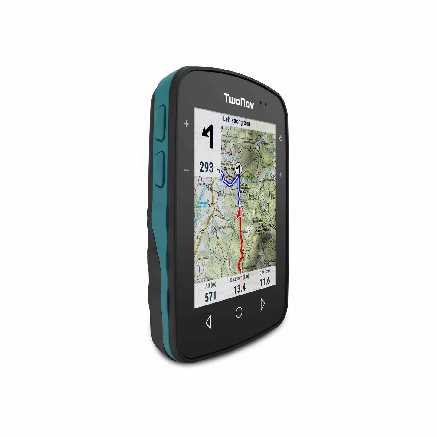
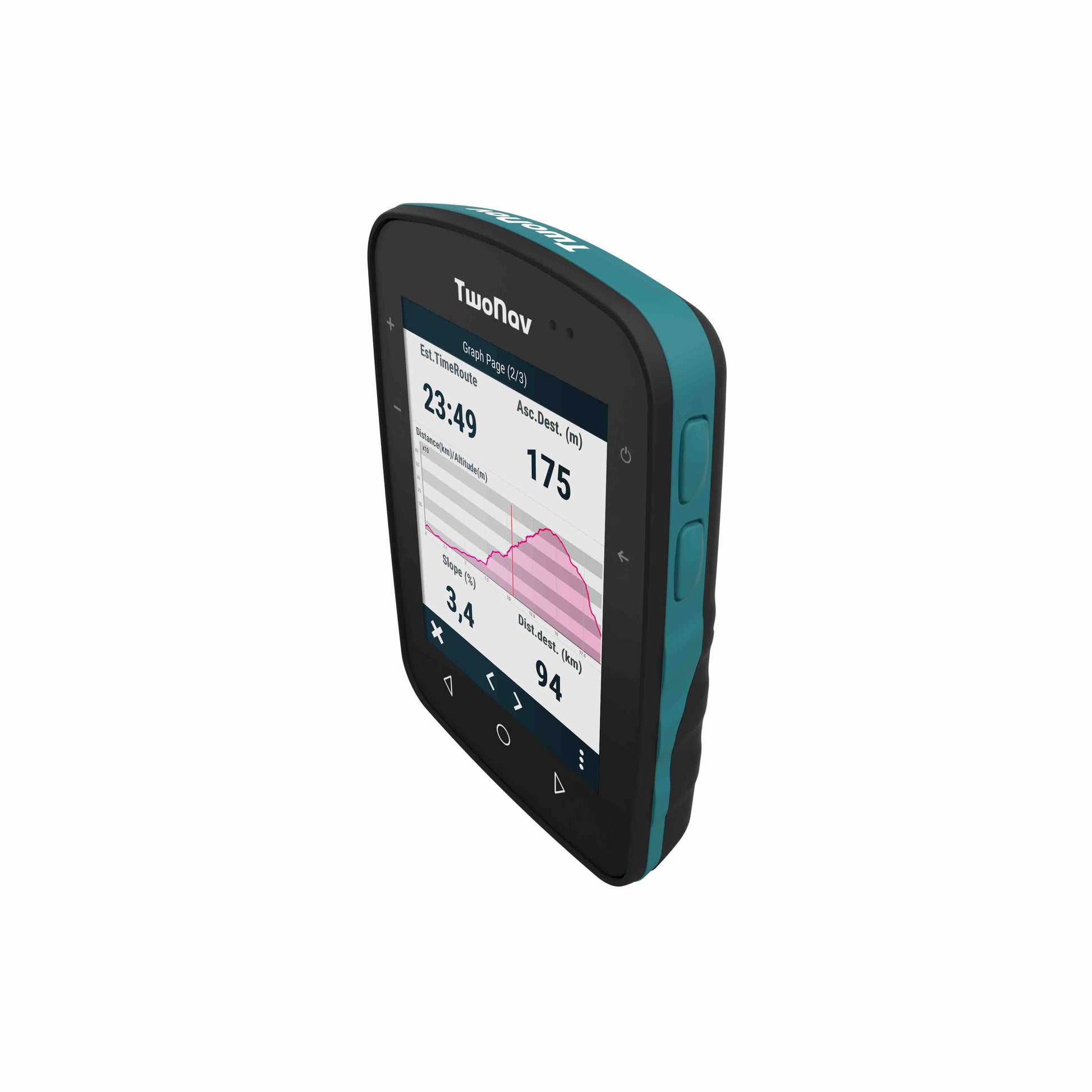
The outdoor navigator for adventure lovers who want to feel the thrill of exploring safely and without limits for all kinds of activities with a larger 3.7" screen.
An Ideal unit for many activities including Hiking, Mountain Biking & Tour Cycling.
When you register your device with TwoNav you can select and download for free 1x zone of Great Britain Ordnance Survey 1:50k Mapping from the 10 x zones as shown in our FAQ's. Additional zones of Ordnance Survey 1:50k maps can be purchased and downloaded, as well as options to purchase & download Ordnance Survey 1:25k maps.
Dare to conquer unknown terrain with confidence
Choose the path to follow wherever you are. When facing an unknown situation, trust Terra, as your mountain guide.
Solve your doubts and choose the right path by seeing your location in real time on detailed mapping.
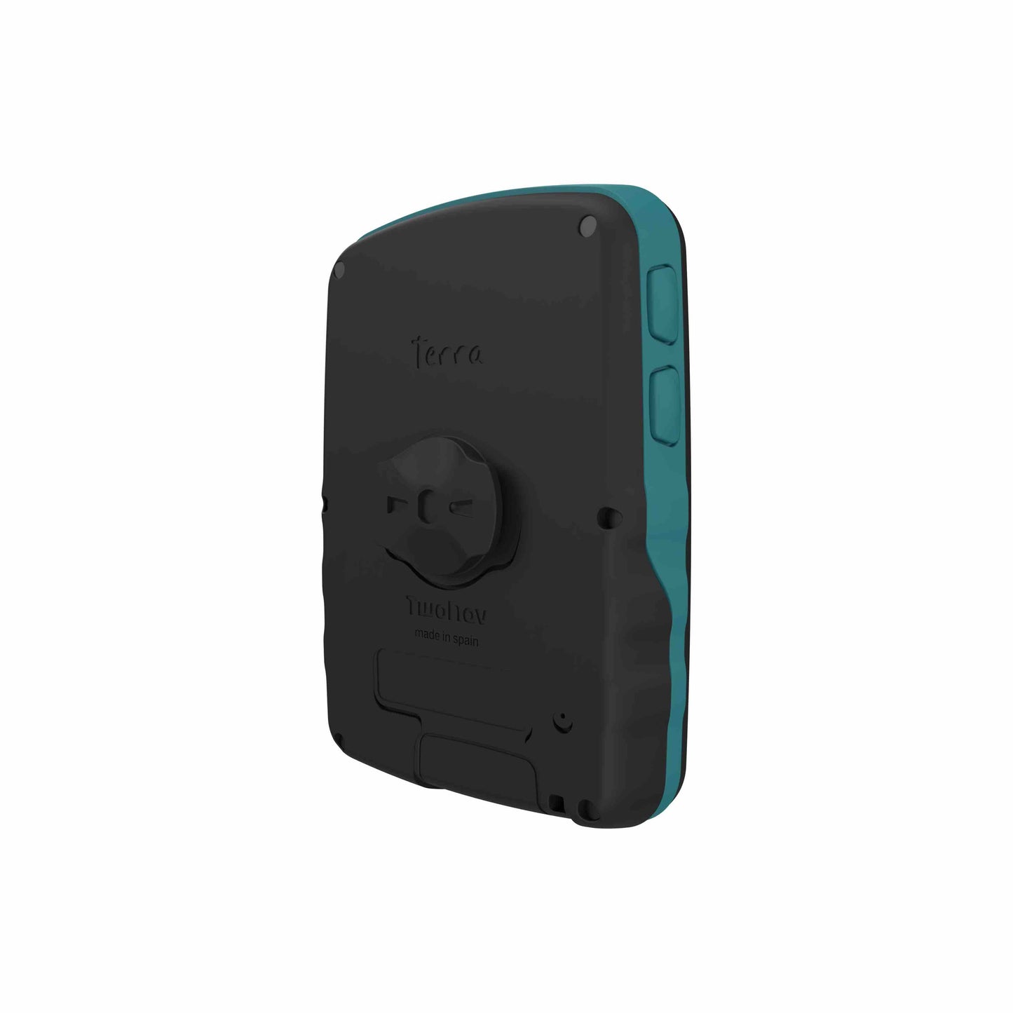
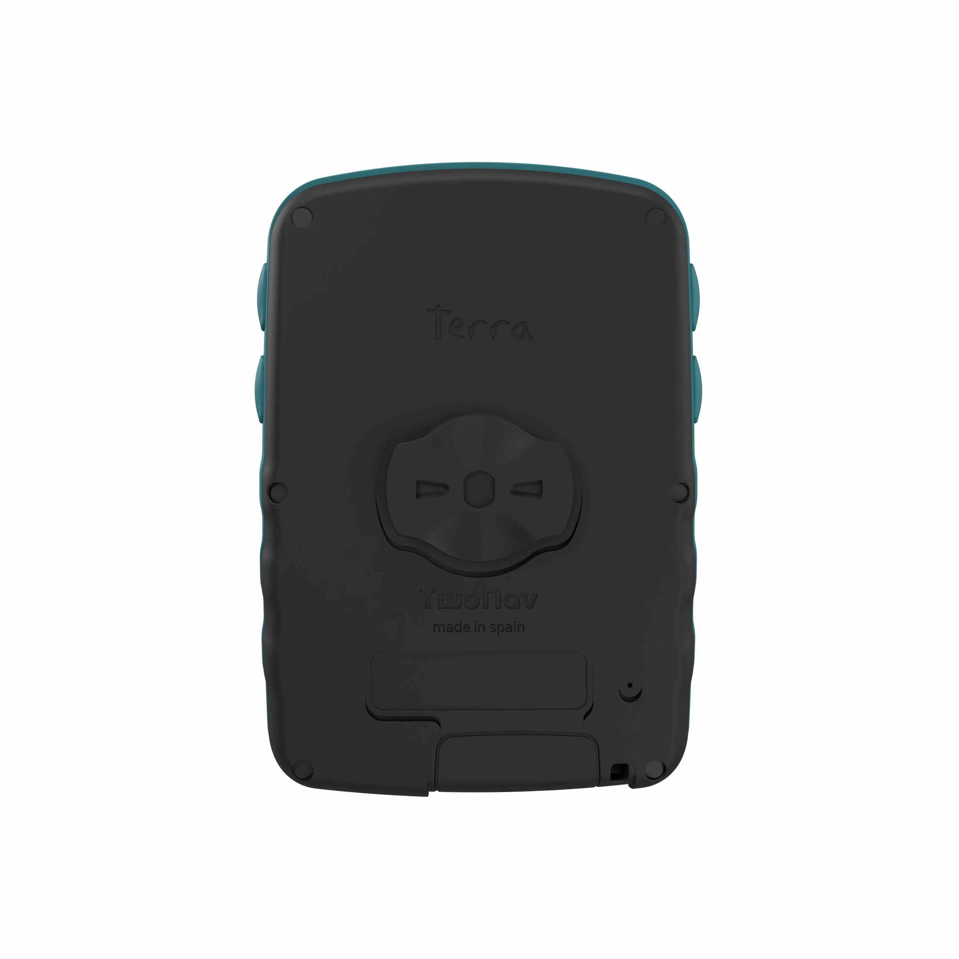
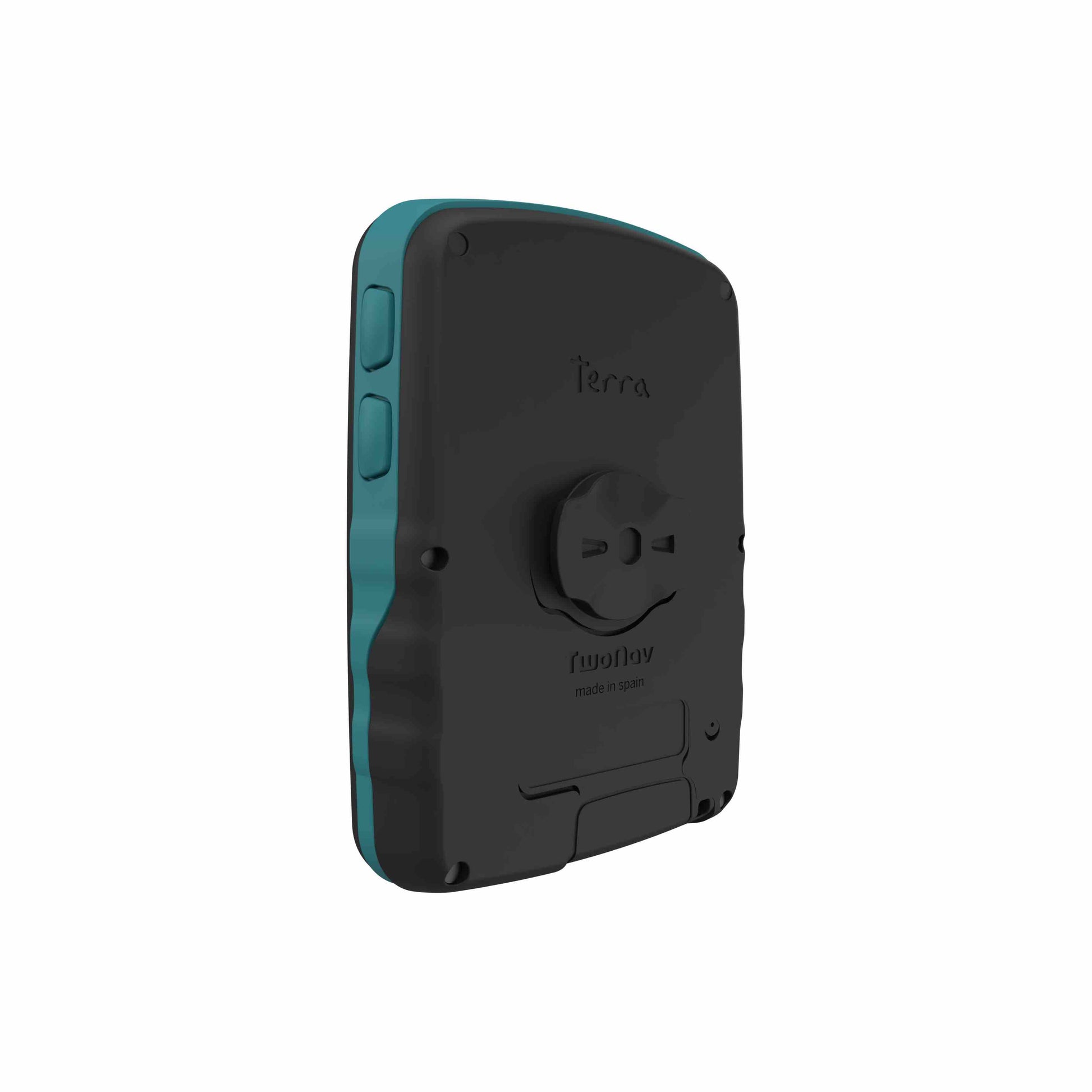
Tough rugged design
With a tough 3.7" Sunlight Readable Touch Screen, Water/dust/mud resistant to IP67, tested to MIL-STD-810 certification for Temperature, shock, water and vibration and Resistant to extreme temperatures -20 °C ~ 70 °C
Accessories available for the TwoNav Terra
- Backpack Tether - More info
- Carabiner Clip - More info
- Carry Case - More info
- Out front bike mount (35mm) - More info
- QuickLock upfront bike mount (31,8-35 mm) - More info
- Screen Protectors - More info
- Spare USBA - USBC Cable - More info
Features
Enjoy a complete and safe experience from start to end. Enjoying your favorite activities safely
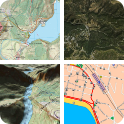
Work with quality maps
Know the relief of the terrain you are about to face from the GPS. With TwoNav you can load maps from the main cartographic publishers and move around them. Get more detail on paths and shortcuts
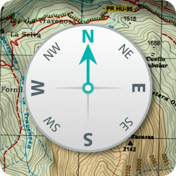
Orientation and navigation
Choose the type of navigation that best suits the type of activity you are going to do: free navigation, follow a track, go to specific coordinates, compass navigation... or simply let yourself be guided by following the indications of a roadbook
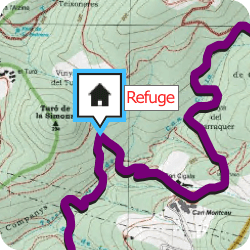
Create waypoints on your route
Add information to your route by creating your own waypoints on the GPS screen. Click on the exact place where you want to create a point and add a name, icon and description (refuge, lake, fountain...)
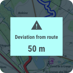
Configurable alerts
Achieve the security you are looking for on your outdoor activities, if you deviate from the planned route, the GPS will notify you so that you can redirect your activity. In addition, if you exceed speed limits, heart rate... you will also receive a warning
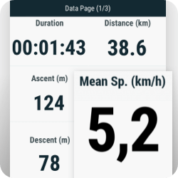
Abundant and reliable data
Track more than 200 data in real time (height, distance, ascent, power, speed...). If you have a heart rate monitor or cadence monitor, connect it and you will receive more information
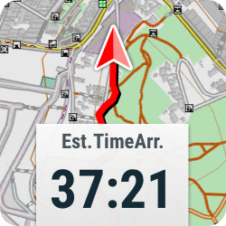
Estimated time of arrival
Let the GPS guide you to destination, you will always know the distance and the remaining time. When you are back, the GPS will calculate the shortest route to return home or to the starting point
Connectivity
Move around with the security of being connected, synchronized and secure

Pair the GPS with the Link™ App on smartphone and you will receive WhatsApp notifications, calls and warnings on the GPS screen. If you store tracks on your smartphone, transfer them to the GPS with Link™

In unknown situations asking for help is essential. With SeeMe™ you broadcast your activity live wherever you are, in addition, you can also send emergency notifications to your contacts
NB SeeME - Requires paired phone with mobile data connection
(6 months SeeME subsciption is included when you register your unit then £29.99 per year to continue the service)

Turn on the GO™ Cloud sync and your activities will be automatically saved to your virtual space, a safe place to store your tracks. Wherever you are, access your activity history from your GPS, smartphone or the internet
Spec's
Physical characteristics:
Dimensions 80 x 115 x 19* mm (*23 mm depth includes QuickLock mounting)
Weight 198 gr
Water/dust/mud resistant IP67
MIL-STD-810 certification
Temperature, shock, water and vibration
Resistant to extreme temperatures -20 °C ~ 70 °C
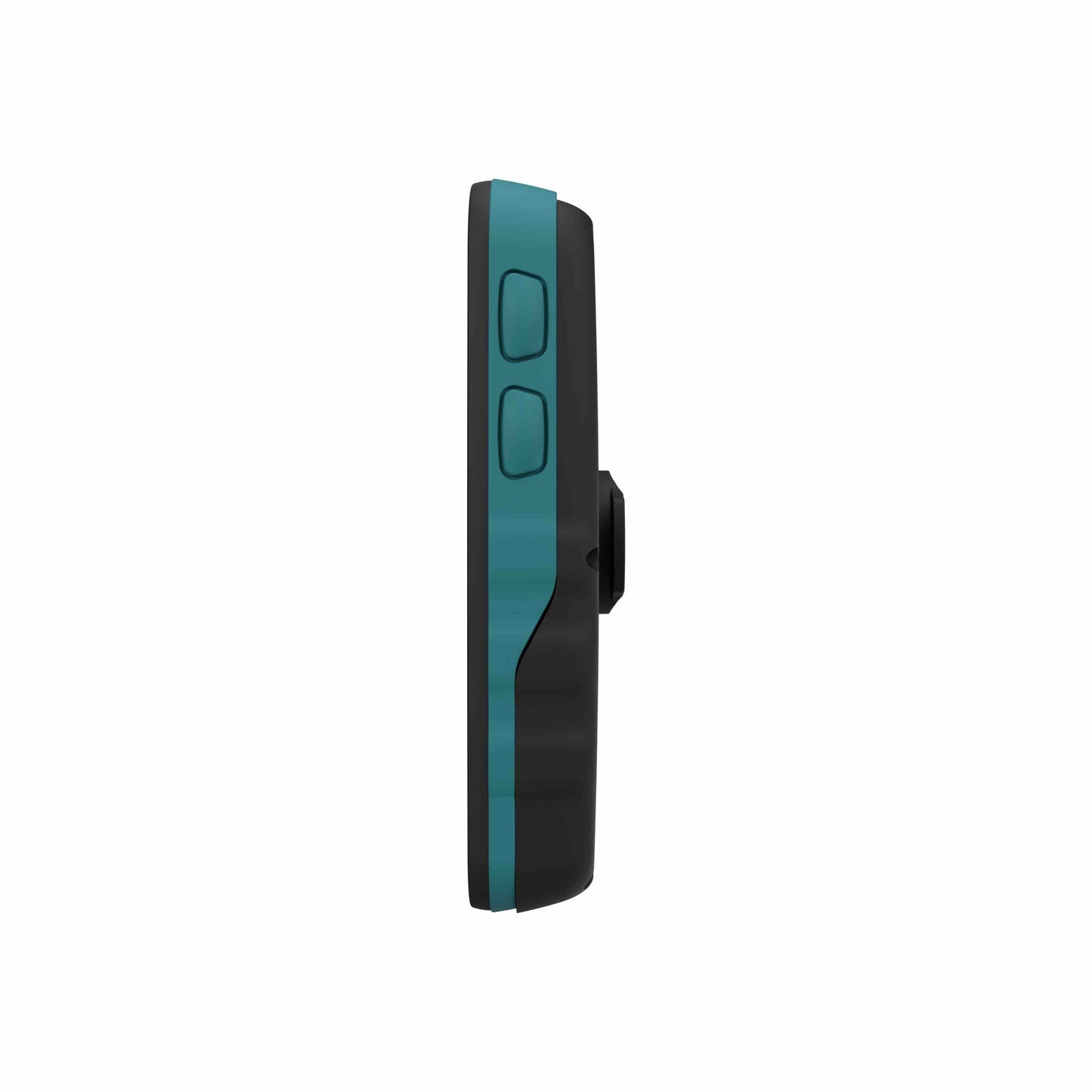
2 x Side buttons for Map Page Zoom in & out
2 x Side buttons for power, screen off and back button
Screen:
Blanview Touch Screen - with Optical Bonding and automatic backlight
Dimensions 3.7’’
Resolution 480 x 640 pixels
Storage:
Internal memory 32 GB (free: 28 GB)
N.B. With the pre-installed Western Europe Map there is 18.2gb of free memory, but you can easily un-install any of the preinstalled countries and reinstall when required.
Battery:
Battery capacity 2600 mAh
Normal battery life 15 h (With GPS Recording - Multi-Band can use more battery)
Battery type Integrated
Charge via USB-C included cable
Sensors
Satellites - GPS, Galileo, Glonass, Beidou, SBAS/EGNOS
Bluetooth Dual
Wi-Fi 2,4 Ghz / 5 Ghz
Audio Speaker
Barometer
Digital compass
Accelerometer
In the Box
TwoNav Terra 32gb
TwoNav Quick Start Guide
Quicklock stem/handlebar bike mount
USB-USB C cable
Regions of OSM (Open Street Maps) can be downloaded worldwide for free
1 x region of Ordnance Survey 1:50k Maps can be downloaded for free, please see our FAQ's tab for more information.
6 months TwoNav PRO subscription plan for free
App TwoNav (Android/iOS)
App Link (Android/iOS)
Personal storage in the GO cloud™
6 months of SeeMe™ for free
2 years manufacturer warranty
FAQ's
1. What are each of the map options that we have available with the Terra?
The Terra 32gb comes pre-installed with OSM (Open Street Maps) for Western Europe including: British Isles, Austria, Belgium, France, Germany, Italy, Netherlands, Portugal, Spain & Switzerland.
When you register your device with TwoNav you can select and download for free 1x zone of Great Britain Ordnance Survey 1:50k Mapping from the 10 x zones as shown below. Additional zones of Ordnance Survey 1:50k maps can be purchased and downloaded, as well as options to purchase & download Ordnance Survey 1:25k maps.
- Great Britain Topo Zones (1:50.000) Cumbria + North-East
- Great Britain Topo Zones (1:50.000) Devon + Cornwall
- Great Britain Topo Zones (1:50.000) East Coast
- Great Britain Topo Zones (1:50.000) Grampians
- Great Britain Topo Zones (1:50.000) Midlands + North-West
- Great Britain Topo Zones (1:50.000) Scottish Highlands + Argyle
- Great Britain Topo Zones (1:50.000) Scottish Islands
- Great Britain Topo Zones (1:50.000) Scottish Lowlands
- Great Britain Topo Zones (1:50.000) South-East + South-Central
- Great Britain Topo Zones (1:50.000) Wales

2. Do the Ordnance Survey Maps cover Northern Ireland, Southern Ireland or the Isle of Man?
No but the following additional maps can be downloaded from TwoNav themselves:
Northern Ireland - Detailed Topo 1:50k Mapping for all of Northern Ireland can be downloaded - More info
Southern Ireland - Included with the Preloaded OSM British Isles Mapping
Isle of Man - Detailed Topo 1:25k Maps can be downloaded FOC - More info
3. What are OSM (Open Street Maps)?
OpenStreetMap Foundation is an initiative with the primary aim of creating and distributing open source geographical data, including street maps and road maps for the whole world. Today OpenStreetMap is a major partner covering unmapped areas of the planet, offering maps of anywhere in the world at highly competitive prices or as an alternative to classic road maps. Its maps also include topographical details which are very useful to users.
4. Are detailed maps available for other countries?
Yes TwoNav have a vast array of maps available to purchase and download for all of the world - More info
5. What is the battery life of the Terra?
The manufacturer's quoted battery life is 15 hrs, we have tested and achieved this with the screen on all of the time @ 50% back-light & using GPS only for recording an activity.
Battery life will be extended by using the screen off modes.
6. How long does the rechargeable batter take to charge?
Using a 2.0ah Mains USB Plug the unit takes approximately 2 hrs to fully charge.
7. How to I transfer GPS Route / Track files to the unit?
You can either connect your device to a computer using the supplied USB-C data cable and copy GPX files straight into the Data folder of device or you can use the TwoNav Link App on a mobile phone to send over a GPS route to your device using Bluetooth.
8. What is the best way to carry my device?
We have a number of accessories available as follows:
- Backpack Tether - More info
- Carabiner Clip - More info
- Carry Case - More info
9. Can I attach the Terra to my Bicycle?
Yes, included in the box with your Terra is a TwoNav Quicklock stem/handlebar bike mount or if you prefer we stock the following out front mount - More info
Only from us
Only from us
- GPS Units - Handheld units are set up by one of the Outdoor GPS Shop team to our recommended settings to get the best out of the unit.
- GPS Units - Quick start guide made solely for Outdoor GPS Shop customers
- Garmin GPS Watches - Guide to registering your watch
Delivery
Delivery
Delivery
Any order placed online before 14.30 will be despatched the same working day.
GPS units/ Watches/ Maps
Any products over £100.00 are posted out using Royal Mail Special Delivery which is guaranteed next-day delivery (before 13.00).
Products - £50.00 - £100.00
Any products between £50.00 - £100.00 are sent out Royal Mail 1st class signed for, so should arrive next day.
Products - below £50.00
Products below £50.00 are posted our Royal Mail 2nd Class so should be with you within x 3 working days.